Our Services

Manned Aerial Surveys
Provision of large format imagery, LiDAR, Oblique and Vertical orthophotos.

GIS Mapping Applications & Training
Utilize our GIS mapping services to visualize and analyze spatial data for effective decision-making in your projects.

Remote Sensing Applications & Training
Experience the latest in remote sensing technology for efficient data collection and analysis in various industries.

Engineering & Construction Surveying
Trust our expert team for engineering surveying services that guarantee accurate measurements for successful construction projects.

Mine Surveying
Our mine surveying services ensure precise measurements and layout for seamless project execution and completion.

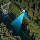
3D Scanning & Drone / UAV Surveying
Data collection of structures and surfaces using the latest technology for reliable datasets

Procurement & Supply of Geomatics Equipment & Software's
Procurement and supply of Geomatics equipment and software's.
Ready to Elevate Your Geomatics Projects?
Explore our comprehensive services to take your projects to the next level with precision and excellence.

